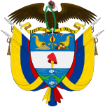
United States of Colombia
This article needs additional citations for verification. (August 2021) |
You can help expand this article with text translated from the corresponding article in Spanish. (June 2015) Click [show] for important translation instructions.
|
United States of Colombia Estados Unidos de Colombia (Spanish) | |||||||||
|---|---|---|---|---|---|---|---|---|---|
| 1863–1886 | |||||||||
 | |||||||||
| Status | Federation | ||||||||
| Capital | Bogotá | ||||||||
| Government | Federal republic Dominant-party (1863 to 1880) | ||||||||
| President | |||||||||
• 1863-1864 | Tomás Cipriano de Mosquera (first) | ||||||||
• 1886 | José María Campo Serrano (last) | ||||||||
| History | |||||||||
• Established | 1863 | ||||||||
| 8 May 1863[1] | |||||||||
• Disestablished | 1886 | ||||||||
| Area | |||||||||
• Total | 1,331,250 km2 (514,000 sq mi) | ||||||||
| Population | |||||||||
• 1870 | 2,681,637 | ||||||||
| Currency | Peso | ||||||||
| ISO 3166 code | CO | ||||||||
| |||||||||
| Today part of | Brazil Colombia Panama | ||||||||
| History of Colombia | ||||||||||||||||||||
|---|---|---|---|---|---|---|---|---|---|---|---|---|---|---|---|---|---|---|---|---|
 | ||||||||||||||||||||
| Timeline | ||||||||||||||||||||
|
||||||||||||||||||||
|
| ||||||||||||||||||||
United States of Colombia (Spanish: Estados Unidos de Colombia) was the name adopted in 1863[2][3] by the Constitución de Rionegro for the Granadine Confederation, after years of civil war. Colombia became a federal state itself composed of nine "sovereign states.” It comprised the present-day nations of Colombia and Panama and parts of northwestern Brazil. After several more years of intermittent civil wars, it was replaced by the more centralist Republic of Colombia in 1886, predecessor to modern Colombia.
History
[edit]The civil war of 1860-1862 resulted in the dissolution of the Granadine Confederation which had been subjected increasingly to efforts by conservatives to centralize rule over the federal states. The liberal General Tomás Cipriano de Mosquera defeated the conservative government of President Bartolomé Calvo during 1862 and was installed as new president. Much power was distributed back to the states from the government in Bogotá.
Already in July 1861, when Mosquera had taken Bogotá and declared himself provisional president of the nation, one of his first acts was to rename the country United States of New Granada. This name was short-lived, as Mosquera changed the name again to United States of Colombia in November of the same year .[4]
Colombian Constitution of 1863
[edit]On 3 February 1863, Congress approved the name United States of Colombia for the country,[citation needed] and on 8 May, the Constitución de Rionegro was promulgated. It established a federal system with a central presidency[citation needed] with a term of two years and without the possibility of immediate re-election. The president was elected by the states. On 12 May, Mosquera was chosen to be the first president.[citation needed]
The liberals attempted to establish the United States of Colombia with a decentralized, free market system. As with previous liberal presidencies, such as Mosquera's first two terms as president, a tough policy towards the Catholic Church was taken, much to the dismay of conservatives. Land possessed by the Church was seized and transferred to industrialists and the influence and rights of the Church was limited severely.
During 1871, attempts at modernization and economic reform resulted in the Colombian peso being associated with the French franc as part of the international gold standard.
Abolition
[edit]After several years of intermittent civil wars, during 1886 the Colombian Conservative Party directed by President Rafael Núñez proclaimed a new constitution of centralist character that abolished the United States of Colombia and created the Republic of Colombia. The conservatives immediately withdrew Colombia from the gold standard and the subsequent increase of printed currency resulted in troubling inflation.
Meanwhile, the new state would continue to be plagued by conflict between liberal and conservative factions, which eventually would result in the secession of Panama during 1903.
States
[edit]The nine original states that formed the confederation were:
- Antioquia State,
- Bolívar State,
- Boyacá State,
- Cauca State,
- Cundinamarca State,
- Magdalena State,
- Panamá State,
- Santander State and
- Tolima State,
and the territories were:
References
[edit]- ^ Constitutional history of Colombia#The constitution of 1863 - United States of Colombia
- ^ Edmundson, George (1911). . In Chisholm, Hugh (ed.). Encyclopædia Britannica. Vol. 6 (11th ed.). Cambridge University Press. p. 171.
- ^ "American Colonies - New Granada". www.historyfiles.co.uk. Retrieved 2021-06-01.
- ^ Jaume Olle. "Nueva Granada (República y Confederación)". Retrieved 1 April 2011.


